 Portal de Dados Abertos
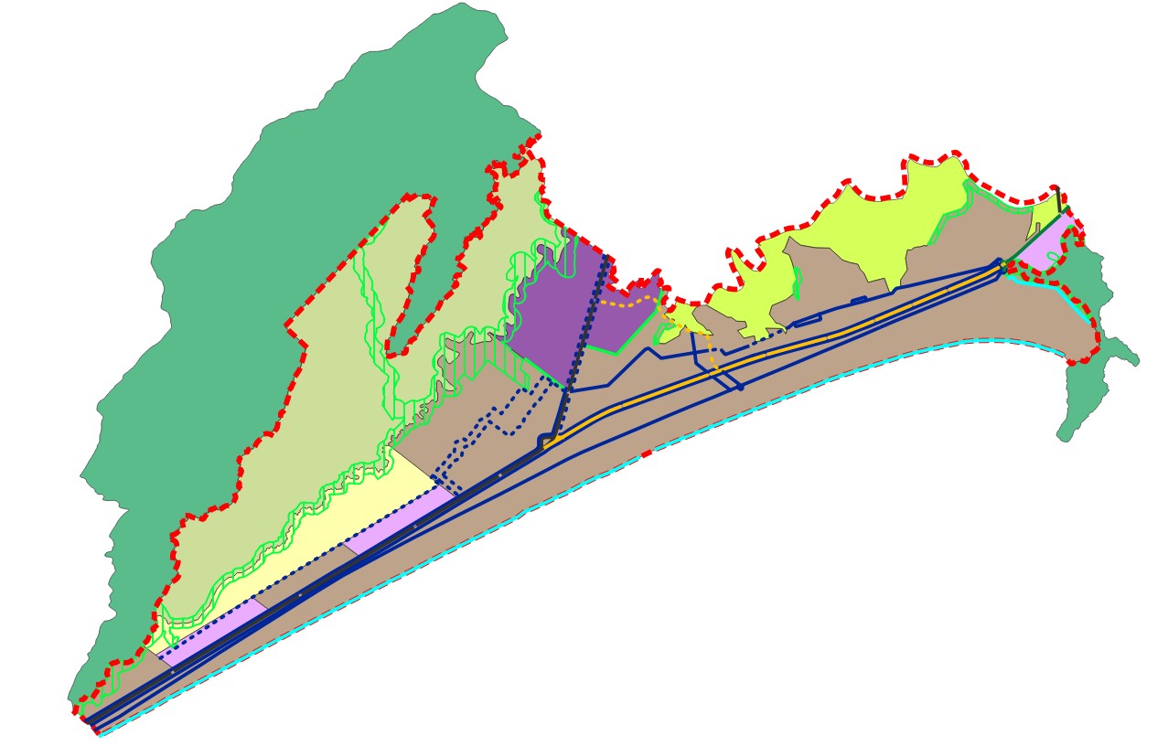
LC 727/2016 - Macrozoneamento
Diretrizes ambientais e de organização territorial, e respeitadas as determinações do quadro natural e cultural do Município, fica estabelecido o macrozoneamento do território conforme a configuração representada na Carta Oficial “Diretrizes de Ordenamento Territorial”. Art. 101 da Lei Complementar 727/2016 - Plano Diretor
Simple
Identification info
- Date (Creation)
- 2016-12-16
- Status
- Completed
Originator
SEPLAN - SECRETARIA DE PLANEJAMENTO
Avenida Presidente Kennedy, nº 9000, Mirim - 1º Andar
Praia Grande
11704-900
- Spatial representation type
- Vector
- Topic category
-
- Imagery base maps earth cover
- Planning and Management
- Boundaries
- Urbanism
N
S
E
W
))
- Keywords
-
- macrozoneamento
- Language
- Portuguese
- Character encoding
Distribution Information
- OnLine resource
-
PraiaGrandeTotal:Macrozoneamento
Macrozoneamento
- OnLine resource
-
Macrozoneamento
Macrozoneamento
- OnLine resource
-
Macrozoneamento_Conceitos%20e%20Notas.pdf
Conceitos e Notas - Macrozoneamento
- OnLine resource
-
PraiaGrandeTotal:PassagensInferiores
Passagens Inferiores
- OnLine resource
-
PassagensInferiores
Passagens Inferiores
Reference System Information
- Reference system identifier
- EPSG / 37983
mdb:MD_Metadata
- Metadata identifier
- urn:uuid / a7075672-4bbc-4916-a996-66a49810b082
- Language
- Portuguese
- Character encoding
- UTF8
Originator
SEPLAN - SECRETARIA DE PLANEJAMENTO
Avenida Presidente Kennedy, nº 9000, Mirim - 1º Andar
Praia Grande
11704-900
Type of resource
- Resource scope
- Dataset
- Metadata linkage
- https://dadosabertos.praiagrande.sp.gov.br:/geonetwork/srv/api/records/a7075672-4bbc-4916-a996-66a49810b082
- Date info (Revision)
- 2025-08-01T16:14:20
- Date info (Creation)
- 2020-07-17
- Title
- ISO 19115-3:2014
- Title
- Perfil MGB 2.0
Overviews
Macrozoneamento
Spatial extent
N
S
E
W
Provided by

Associated resources
Not available